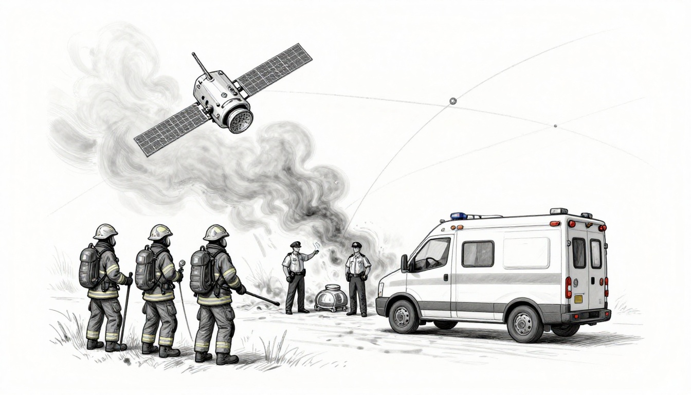
Picture firefighters trapped in a wildfire, boxed in by smoke, and staring at a blank cell bar that never comes back. When they can’t rely on towers or power, satellite communication emergency services gives them a way out, letting them call for help and share their GPS location to the teams that can reach them.
Police, fire departments, and ambulances use satellite links so they can keep working when disasters knock out phone lines and leave dispatch centers blind. In 2025, Hurricanes Helene and Milton showed this clearly, when back-to-back storms damaged networks across parts of Florida, Georgia, and North Carolina; teams deployed satellite terminals that connect fast and keep voice and data moving. Similar examples also show up in sudden events like major earthquakes, where portable satellite phones and terminals help field teams coordinate and assess damage even after terrestrial systems go down.
Because communication decides who gets rescued first, the key is understanding how satellites carry voice, GPS, and real-time location data when everything else fails. Next, you’ll see why satellite links work so well for disaster response, including the most common uses and real cases from 2025.
Why Satellites Become Lifelines When Disaster Hits Local Networks
When local networks break, it stops feeling like “technology trouble” and starts feeling like a rescue problem. Ground systems are built for normal days, but disasters punish weak spots fast. That’s why responders turn to satellites once towers, lines, and power can’t carry the load.
The Big Problems with Ground-Based Communication in Crises
Ground-based communication has a long list of failure points. And in real disasters, multiple problems hit at once, not one at a time.
For example, during the 2025 Los Angeles-area wildfires, reports highlighted how warning and alert systems did not reach people when they needed them most. Smoke, fast-spreading fire, and damaged infrastructure can turn “send a message” into “message never arrives” or arrives too late to help. See how coverage described these warning breakdowns in LA wildfire alert warning lags.
Here are the top ways local networks fail when the sky turns hostile.
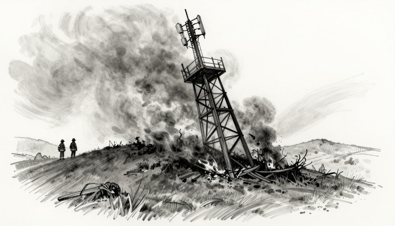
- Damaged towers in wildfires (heat, smoke, and direct fire damage): Fires don’t just burn homes. They can damage antennas, microwave links, and shelter power systems. Even if a tower survives, smoke can worsen signal quality.
- Flooded lines and site access in storms and floods (Hurricane Helene-like impacts): When water rises, it can flood fiber routes, knock out cabinets, and take down power supplies. Then crews also struggle to physically reach repair sites.
- Blackouts in earthquakes and severe weather (power loss cascades quickly): If power drops, cell sites often go dark after backup batteries run out. Dispatch centers and backhaul links can fail too.
- Network congestion when everyone calls at once: When fear hits, people press “call.” If tower capacity gets overwhelmed, even people near a functioning site may hear dead air.
- Backhaul interruptions (the “roads” between towers): Even a tower with antennas can fail if the fiber or wireless relay that feeds it goes down.
These issues create a real risk for responders, not just residents. Without working comms, teams lose the shared picture.
Think about it like trying to run a kitchen during a blackout. You can still move, but you lose timing. You might not know where the fire line is forming, which roads are blocked, or who needs evacuation first.
When responders cannot coordinate, the downstream effects show up fast:
- Delayed rescues: Crews waste time searching for locations and routes.
- Routed mistakes: Teams may drive into hazards because they did not get a live update.
- Lost accountability: Command might not track which units are safe, delayed, or stuck.
- Slower triage: EMS and police cannot quickly exchange patient counts, hazards, and staging areas.
In 2025, the pattern stayed consistent across big disasters: when phones stop working, people still need help, and responders still need a common channel. That’s the gap satellites close.
How Satellites Outshine Traditional Options
Satellites matter because they don’t rely on the same fragile local pieces. When ground systems fail, satellites keep sending a signal from above the storm and far from local damage.
First, satellites work in bad weather better than many street-level links. Heavy rain and smoke can still interfere with some connections, but satellites give emergency teams options that do not depend on a nearby cell tower. In other words, you are not asking a burned-out site to save you.
Second, satellites often require little or no fixed infrastructure. Many setups are portable, so a commander can move equipment to the right spot. That makes a difference for mobile units like ambulances, fire trucks, and incident command vehicles. Instead of waiting on repairs, teams can set up near staging areas and start talking.
Also, satellites can provide global reach for cross-state coordination. If one region gets hit hard, mutual aid teams need a way to share situational updates and GPS positions. Ground networks tend to stay local. Satellites do not.
Here’s the practical advantage: you can treat satellite links as a backup pipe that runs even when the usual pipes burst.
For short bursts, satellite connectivity can be low cost and efficient, especially for tasks like voice checks, text-like updates, and sending GPS location. You do not need full-time broadband everywhere. Instead, you need just enough reliable channel to move decisions forward.
Low-latency matters too. With low-Earth orbit (LEO) systems, connections can feel quicker than older satellite networks. That helps when field teams need fast back-and-forth, like confirming an address, reporting fire spread, or coordinating evacuation routes.

In 2025, responders leaned on satellite tools in multiple disasters. Starlink, for example, uses satellites in low orbit to deliver internet service quickly in remote or damaged areas. It also supports emergency response efforts, which Starlink describes in its Emergency Response overview. Meanwhile, Iridium-type satellite phones give basic voice and data anywhere, which helps when towers vanish completely.
Even better, satellite systems can help with message delivery when phones lose normal service. In previous hurricane responses, satellite-to-phone features supported alerts and emergency messages when local networks struggled, which you can see tied to the broader response model described in disaster communications reporting like Emergency telecommunications support for Hurricane Melissa.
So what does all this mean on the ground?
- You get a working channel when towers go down.
- You can set up quickly with portable gear.
- Teams in different states can coordinate without waiting for local repairs.
Satellites become lifelines because they bring back the one thing disasters steal first: the ability to talk, share location, and decide what to do next.
Core Ways Responders Rely on Satellite Tools for Action
When disaster knocks out cell towers and Internet backhaul, responders need one thing immediately: a way to act. Satellite tools give them that ability. They restore voice, push alerts, share maps and images, and even track locations when every other system struggles.
Think of satellite comms as a second set of hands. You might not need it in normal life. But once the primary grip slips, you realize how much you relied on it.
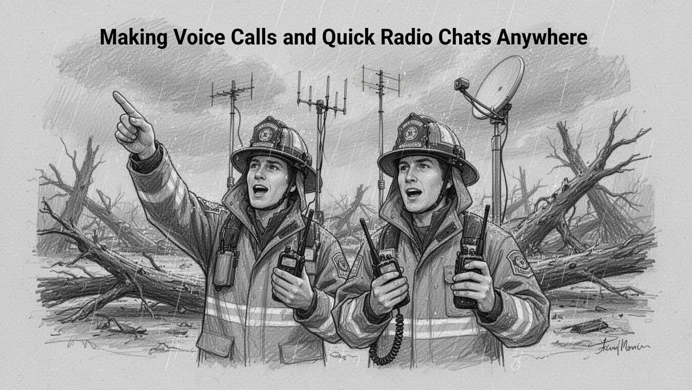
Making Voice Calls and Quick Radio Chats Anywhere
Satellite phones and push-to-talk devices let responders speak directly, even when local service collapses. With a satellite phone, you dial like normal. With push-to-talk, you speak like a radio, quick and simple. Both reduce the time between a problem and a request for help.
In the chaos after Hurricane Maria, responders leaned on satellite connectivity when cell coverage and power became unreliable across parts of Puerto Rico and the U.S. Virgin Islands. Similarly, during major earthquakes, teams reported using satellite phones to keep coordination moving when networks struggled or went dark.
The setup feels almost too easy. You point the antenna or device toward the sky, then you talk. That fast “aim and go” matters when seconds count. Instead of waiting for cell towers to recover, you send the message now, while the rescue plan still has momentum.
Here’s what this method typically supports in the field:
- Direct voice contact with incident command, dispatch, or mutual aid partners
- Urgent check-ins when units become isolated or split up
- Simple alerting for medical emergencies and evacuation requests
- Short bursts of coordination while teams move to safer ground
For background on how satellite networks help during outages, see Iridium connectivity during disasters.
In short, satellite voice is often the first bridge responders rebuild. It gets people talking before they ever start sending bigger data.
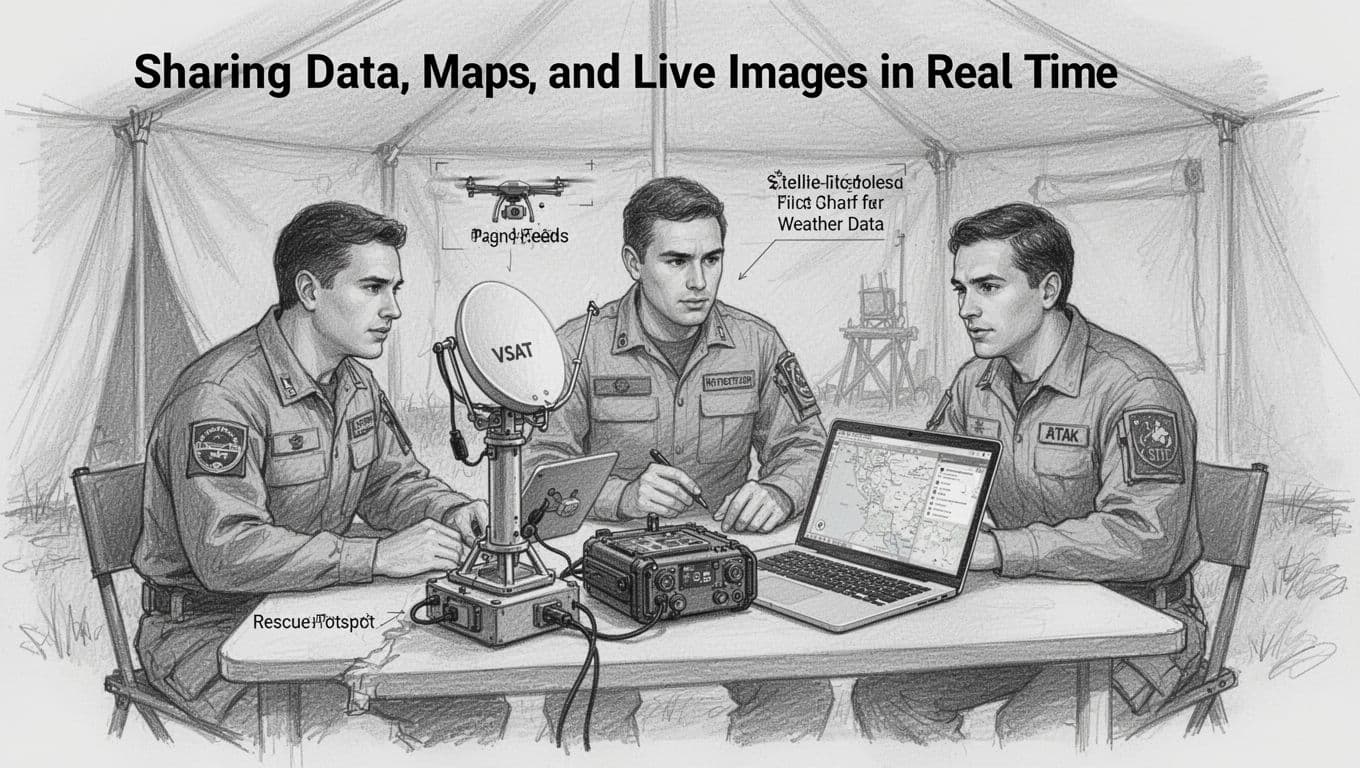
Sharing Data, Maps, and Live Images in Real Time
Voice helps you ask for help. Data helps you find the right help. That’s why responders also rely on portable satellite hotspots, field terminals, and situational apps that can send real-time or near-real-time updates.
Portable satellite systems, including equipment marketed by providers like Hughes VSAT and Viasat, often support internet access for laptops and tablets. In practice, that can mean sending video, uploading weather observations, and sharing drone feeds from the incident perimeter. When you can see what’s happening, you spend less time guessing.
Teams also use mapping and mission apps to keep everyone aligned. One example is ATAK (Android Team Awareness Kit), commonly discussed for situational mapping and incident overlays. In a fast-moving response, these maps help commanders compare hazard zones, staging areas, and unit positions without waiting for a slow sync to come back.
For flood risk and map layers, FEMA also provides tools responders can use after alerts and hazard info are available. For instance, FEMA’s flood data viewers help teams work with geospatial hazard layers when planning routes or shelter needs. You can explore FEMA flood data viewers for that geospatial background.
When a response needs quick, consistent connectivity, antenna hardware matters too. For example, Cubic’s GATR solutions have been referenced in FEMA-related disaster connectivity efforts, where the goal is to stand up internet service quickly for responders in damaged areas.
A realistic way responders use this workflow looks like this:
- A team captures drone footage or field notes.
- They upload key details through a satellite hotspot.
- Command updates routes, staging, and priorities on a shared map.
The payoff is safety. Fewer trips become wrong turns. Fewer teams get sent into areas they cannot assess first.
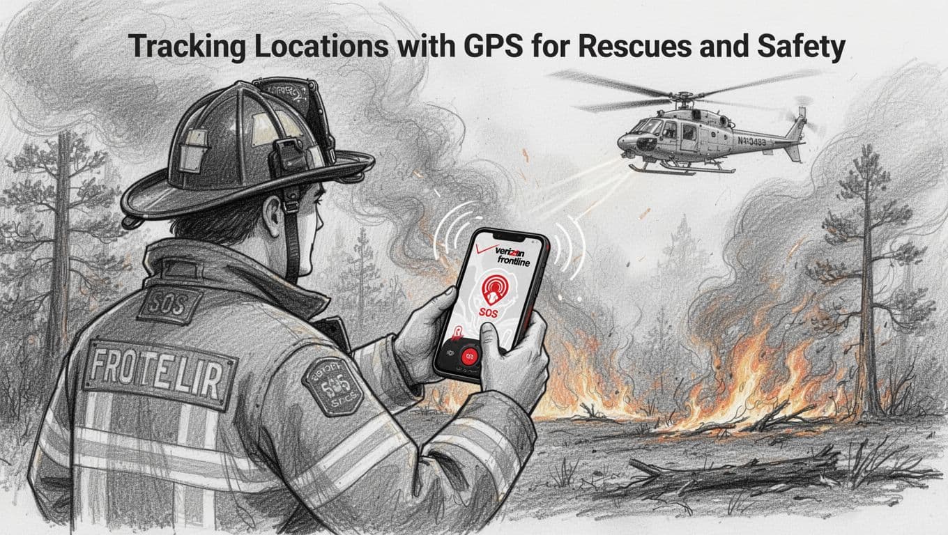
Tracking Locations with GPS for Rescues and Safety
Satellite GPS emergency tracking turns “I think I’m here” into “we know exactly where you are.” That shift improves rescue speed and reduces risk for both trapped people and the teams searching for them.
Devices like Globalstar SPOT and Iridium RockSTAR send location and emergency signals from where cell service fails. Typically, you press an SOS button. Then the device communicates through the satellite network and routes your request to response support. For a closer look at SPOT capabilities, see Globalstar SPOT for business.
Firefighters and rescue workers rely on this kind of location sharing when terrain blocks line-of-sight, and when smoke hides landmarks. The rescue team can plan access routes faster. They can also coordinate with aircraft and ground units without relying on radio guesswork.
In addition, satellite-enabled smartphone services can extend that same idea to firefighters in coordinated operations. Verizon’s Frontline program has been discussed in connection with emergency response connectivity and field operations, including the role of satellite and communications upgrades that support tough conditions. For an example of how Verizon Frontline ties into emergency communications infrastructure, see Verizon Frontline with iDirect.
GPS tracking also supports better decision-making for medical evacuations. In Sweden, reported improvements to emergency response workflows show how GNSS-enhanced systems help 112 responders pinpoint emergencies more accurately. That matters for faster routing and less time lost to address confusion. You can read about this in GNSS-enhanced Sweden’s 112 response.
In short, satellite GPS emergency tracking helps teams stop searching in circles. It narrows the problem to a target.
Linking Teams Across Agencies for Smooth Coordination
Disasters do not respect jurisdiction lines. One incident often pulls in police, fire, EMS, public works, and nonprofit partners. Satellite tools keep those groups connected when their own radio networks and networks-in-the-area break down.
FirstNet’s satellite connectivity approach is one path public safety agencies use to extend coverage when towers fail. For details on how FirstNet discusses satellite connectivity for emergency communications, see FirstNet satellite connectivity. The promise is simple, responders keep voice, data, and text working when normal coverage is gone.
Other providers focus on emergency responsiveness and satellite voice and broadband links for field reporting and coordination. ConnectaSat, for example, has published information about using satellite connection for rescue missions and emergency response. You can see that overview in ConnectaSat emergency responsiveness.
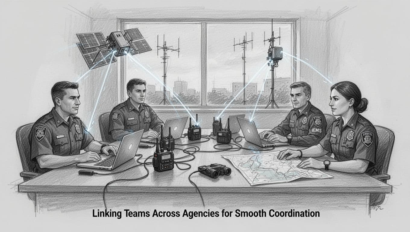
Command centers also depend on satellite modems and rapid-response terminals to push stable connectivity to leadership and planning teams. That type of link helps reduce mix-ups like:
- Sending two units to the same blocked road
- Dispatching resources without the latest hazard picture
- Losing accountability when teams rotate at shift change
Even broad international response partnerships have used satellite connectivity in recent hurricane season preparations. For one example, Intelsat has discussed rapid-response connectivity efforts in advance of major storm periods. See Intelsat and rapid-response connectivity.
Bottom line: when agencies share the same satellite-backed picture, coordination speeds up. Decisions become clearer. And fewer teams get hurt while everyone waits for communication recovery. {“tool”:”generateImage”,”args”:{“sectionTitle”:”Texas Floods and Hurricane Helene: Texting to Safety”,”imageIntent”:”Show responders using a satellite-connected phone for SOS texting during flood conditions, with stormy sky and emergency vehicle context in a hand-drawn sketch style.”,”prompt”:”hand-drawn sketch style, graphite linework with light shading, scene of an emergency responder holding a smartphone receiving SOS satellite text, nearby portable satellite hotspot on an emergency vehicle hood, rain and floodwater in the background, cloudy sky, dynamic composition, clean white paper background, no readable text, no logos, no watermarks”} }{“tool”:”generateImage”,”args”:{“sectionTitle”:”California Wildfires: Firefighters Stay Connected”,”imageIntent”:”Illustrate firefighters coordinating using satellite SOS on phones and field tracking with a tablet/map overlay, with burned landscape and smoky sky, monochrome graphite sketch.”,”prompt”:”hand-drawn sketch style, graphite linework with light shading, scene of two firefighters in protective gear near a wildfire perimeter, one uses a satellite-enabled phone while the other checks a rugged tablet showing a generic map view (no readable text), smoke haze and burnt trees in the background, slightly angled perspective, clean white paper background, no readable text, no logos, no watermarks”} }## Proven Wins: Satellite Success Stories from 2025 Disasters
When networks fail, satellite comms turn into a simple promise: someone can still reach you, and you can still show where you are. These 2025 stories show the wins that matter, quick SOS texts, faster routing, and teams staying accountable even when towers melt or go dark.
Texas Floods and Hurricane Helene: Texting to Safety
Texas floods in 2025 made one thing painfully clear. In a fast-rising flood, you do not have time to wait for signal bars. You need a message that goes through, right now, even if your area has gone dead.
T-Mobile’s Starlink-powered approach, branded as T-Satellite, helped people connect during the July 2025 flooding by enabling Starlink SOS texts. According to reported results, 93,700 people were able to connect, sending 287,000 SMS messages and receiving 125 wireless emergency alerts. The key win here is that the system supports location sharing, so responders can find you without guessing which road you took.
That location piece matters like a flashlight in smoke. A caller can say, “I’m near the bridge,” but responders still need an exact spot to send the right unit. With location-aware SOS texting, the call for help turns into actionable data for incident teams and search groups.
Inside response operations, this kind of texting also helps shelters and command points coordinate. T-Mobile also described T-Satellite as working when disasters hit and regular networks struggle, which you can see in their newsroom coverage of the service and disaster-response focus: T-Mobile T-Satellite service details.
Here’s where it gets even more practical in field conditions: when phone networks get wrecked, teams still need a way to track people and units. That is where tools like ATAK come in. In a chaotic environment, a map overlay can help crews see who is moving, where hazards are forming, and which groups are still in contact. Even if wrecked networks stop normal check-ins, team tracking can keep operating, then sync again when connectivity returns.

At the same time, satellite internet support added room for response work beyond text. Starlink-backed support during flood relief has also been reported in coverage of emergency connectivity efforts: Starlink supports Texas flood relief. When connectivity comes back in small pockets, command can push updates, families can check on status, and field teams can share what they see.
The bottom line for Texas floods and Hurricane Helene-style impacts is simple. SOS texting plus location sharing helps get help moving fast. And when networks fail harder, team tracking tools like ATAK help keep people safe and accountable.
California Wildfires: Firefighters Stay Connected
Wildfires push communication in two directions at once: they destroy infrastructure and they spread smoke fast enough to make delays deadly. In California’s January 2025 wildfire surge, the fire itself moved so quickly that even well-prepared teams needed a reliable way to coordinate once power and tower coverage became uncertain.
While official reporting often focuses on the fire footprint from space, satellite value during wildfire response also shows up in the operational layer. Satellite-enabled SOS on phones and other satellite pathways give firefighters a fallback when towers struggle under smoke, power shutoffs, or evacuation surges.
In practice, firefighters do not need full broadband to stay effective. They need short, dependable messages. A quick “I’m trapped,” a location ping, or a request for a route change can prevent a unit from getting cut off.
Satellite data also supports the reason those messages matter. When satellites track active fire edges and smoke plumes, incident command can adjust plans sooner. That reduces the guesswork that burns time and resources. NASA and other Earth-observation systems captured burn scars and active fire patterns across the Los Angeles-area fires in mid-January, helping teams map where danger grew. Satellite imagery supports the same goal that a phone SOS does, reduce uncertainty fast.
For communication coverage linked to disaster conditions and direct-to-cell solutions, there’s also reporting on the connectivity side of the LA wildfires. One example is a broader industry write-up on alternative connectivity during the January 2025 fires: Satellite direct-to-cell lifeline in LA fires. This matters because it frames a real responder need: when terrestrial networks falter, teams still need a method to send urgent updates.
Meanwhile, Verizon’s updates during the Southern California wildfire response point to how carriers plan for coverage needs when wildfires disrupt service: Verizon’s Southern California wildfire updates. Even when details vary by incident, the repeated pattern stays the same. Firefighters and public safety teams need communication that survives power loss, site damage, and heavy call volume.

So what does “stay connected” actually mean in the field? You see it in outcomes like:
- Quicker evacuation decisions, because commanders can confirm where units are and which roads remain usable
- Better unit safety, because SOS messages with location reduce time lost to radio guesswork
- Faster handoffs, because teams can keep coordination during shift rotations even when normal coverage is shaky
The wildfire lesson is blunt. Smoke and melted towers do not wait for network recovery. Satellite-backed options keep voice, texts, and position awareness available long enough to move people out of danger.
Other Key Moments Like Puerto Rico and Beyond
Some satellite wins do not come from one cable cut or one flood crest. They come from big storms that flatten communication options across whole regions.
Hurricane Maria in 2017 is still a reference point because it showed how Iridium-type satellite phones helped responders communicate when terrestrial networks struggled. The lesson carried into later years: when your ground network fails, a satellite voice path can keep command and field teams in contact.
More recently, other systems showed up in aid-response planning for emergencies. Viasat has been described in connection with supporting aid groups during major disasters, often by providing connectivity where local service did not reach quickly enough. That matters because aid groups do more than coordinate. They provide status updates to families, move supply plans, and track where help is needed most.
If you look at the broader market picture, the demand signal keeps getting stronger. Satellite communications for disaster response sits within a fast-growing industry. One market summary places the broader satellite communications market at about USD 93.71 billion in 2024, with an expected rise over the coming years, and it also estimates public-safety and disaster-response as a growing subset. In other words, more organizations see satellite comms as part of emergency readiness, not just a backup plan.
For readers, the takeaway is not “every system solves everything.” Instead, these moments show a consistent pattern:
- Satellite voice or texting bridges the gap when towers fail.
- Satellite connectivity supports coordination for agencies and aid groups.
- Location and short messages reduce rescue delays, especially when roads and access points change hourly.
Disasters keep changing the ground truth, flooded roads in Texas, shifting firelines in California, and wide-area outages after major hurricanes. Yet satellite comms keep delivering the same core win. When normal networks break, help can still move, and people can still be found.
Looking Ahead: Next-Gen Satellite Tech for Even Better Emergencies
Satellite communication for disasters keeps getting smarter. In 2026, the biggest shift is simple, more people can send an SOS from their own phone. At the same time, space networks keep growing, and the systems that move data between satellites get faster.
When you picture it, think of today’s satellite links as a backup radio. Next-gen tech turns that backup into a stronger, more automatic path for help.
Direct-to-phone SOS becomes normal for major devices
For responders, every minute matters. For callers in the field, the biggest problem is usually the same one, they lose access to cell towers.
That’s why direct-to-phone SOS keeps expanding in the US. Instead of relying on a separate satellite phone, people can send emergency messages from mainstream smartphones. Reports describe how direct-to-device satellite texting works on newer phone features, along with what users can expect during real emergencies (for example, when messages route through a satellite network even without normal service) in direct-to-device satellite texting on new smartphones.
Here’s the practical impact for emergency services:
- Fewer dead zones for distress messages, because the phone can still reach a satellite path.
- Better triage signals, since SOS messages include location information that helps teams stop guessing.
- More consistent communication, because people do not need to hunt for a special handset.
Also, phone support matters for scale. In disasters, you do not just need enough responders. You need enough people who can report what’s happening from where they are standing.
If you care about how the broader market is shifting, Deloitte also tracks how direct-to-device satellite connectivity keeps changing capacity and regulation in next-gen satellite internet predictions.
LEO networks scale up toward more satellites and better coverage
Next, look at the stars themselves. Low-Earth orbit (LEO) constellations are expanding. With more satellites overhead, coverage gaps get smaller and signal strength gets more consistent.
Some industry forecasts focus on growth toward 18,000-plus satellites, and that matters in emergencies. Floods, wildfires, and hurricanes often damage ground infrastructure in uneven ways. One neighborhood might have partial service, while another has none. More LEO capacity can help reduce that “patchwork” feeling.
However, scale brings new responsibilities. As networks grow, they also need stronger rules for security and resilience. Emergency teams need confidence, not surprises.
In addition, LEO helps when responders need to move fast. Portable systems do not have to wait for towers to return. They can connect while crews set up staging areas, shelters, and field commands.
Meanwhile, some new response designs blend air, space, and ground links to restore connectivity inside the first critical window. Reporting on integrated systems for disaster response highlights how combined networks can help restore communications when time is tight, like the 72-hour rescue window described in CTECC and ZTE disaster response with an intelligent emergency system.
In short, more satellites help reduce outages. But the real win is reliability during messy, real-world conditions.
AI routing and laser links push video and voice closer to real time
Now comes the brains and the pipes. Next-gen satellite systems increasingly use AI-based routing to decide where data should go. When weather changes, traffic spikes, or a link degrades, AI can shift paths faster than a manual plan.
For emergency services, this shows up as:
- Fewer dropped sessions when calls or data links get unstable.
- Smarter prioritization, so voice and SOS updates move ahead of less urgent traffic.
- Faster updates, because systems can adapt during the response, not after it.
At the same time, inter-satellite laser links aim to move traffic without constant reliance on ground stations. Instead of sending everything down to Earth and back up, satellites can pass data between each other. The outcome is often less delay for time-sensitive needs.
That matters for more than streaming video. Responders also need clear voice during command handoffs. They need short field reports. They need live views that help confirm hazards and guide routes.
Eventually, these upgrades support a bigger goal, global response teams can coordinate with less friction. Even when a local region is dark, the network path stays available. And when people can send a distress signal from their own phone, faster routing turns that signal into an actionable plan.
The bottom line is hopeful. Next-gen satellite tech is closing digital gaps, not widening them. Better direct-to-phone SOS, more LEO coverage, and smarter routing mean emergencies can get help sooner, with less guesswork and more clarity.
Conclusion
Satellite communication helps emergency services keep doing their job when towers and power fail. Because satellites can send voice, alerts, and GPS location, responders find trapped people faster and coordinate across agencies without waiting for local networks to come back.
In recent major disasters, satellite links also supported quick SOS messaging, field data sharing, and even hybrid setups that mix satellite types for better coverage. As a result, help can reach the right place sooner, even when conditions feel chaotic.
Now that satellite-to-phone options keep improving, your next step is simple: check your phone’s SOS satellite features (and set up any guidance your carrier provides). Then share this post, and learn more on provider sites like Starlink and Iridium so you know what to do when you need help most. What satellite feature would you want to have ready before the next storm hits?