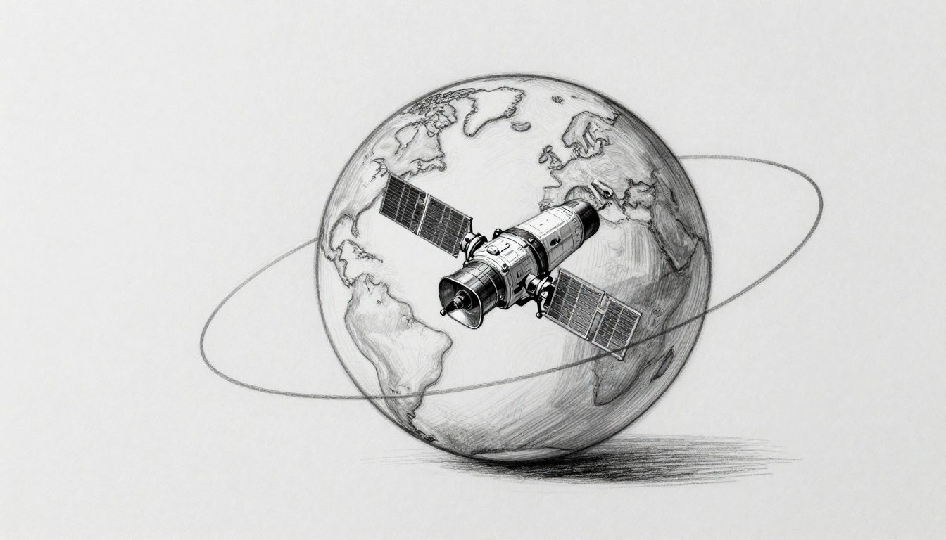
If your satellite TV picture never needs “fine-tuning,” you’ve benefited from geostationary satellites. These spacecraft hover over the same point above Earth. So your dish stays pointed, even though Earth keeps spinning.
That raises a simple question: how do they stay put, instead of drifting away like a thrown ball?
The answer is a careful match of speed and height. In GEO orbit, a satellite’s orbital period lines up with Earth’s rotation. At one specific altitude near 35,786 km (22,236 miles), gravity pulls inward while orbital motion pushes outward just enough. As a result, the satellite appears fixed over the equator.
Then there’s the second challenge. Space isn’t perfectly still. Tiny forces slowly nudge the satellite off its spot. To fix that, operators perform station-keeping, which means regular, small thruster burns.
Let’s break down the physics in plain English, plus the real-world issues that keep GEO working for weather, TV, and communications.
The Physics Trick That Matches Satellite Speed to Earth’s Rotation
An orbit is a balance between gravity and motion. Gravity wants to pull a satellite down toward Earth. Meanwhile, the satellite’s sideways speed gives it enough “arc” that it keeps missing Earth.
For a geostationary satellite, the goal is not just “an orbit.” The goal is an orbit that takes the same amount of time as Earth’s rotation. Earth spins once about every 24 hours. More precisely, the matching time is one sidereal day (about 23 hours 56 minutes). When the satellite’s orbital period equals that time, it stays lined up over the same longitude.
Distance matters. Higher orbits take longer to complete each lap, because the satellite must travel farther each circuit. So there’s one sweet spot where the timing works out. At that spot, the satellite also sits over the equator, because the orbit must have about 0 degrees inclination.
Here’s a kid-on-a-merry-go-round analogy. If you walk outward from the center, you’d normally move at the same speed as the ride’s outer edge. But you could also try to move in a way that keeps you synchronized with a point on the floor. GEO is like choosing the right radius and matching your pace to stay aligned with Earth’s turning.
At GEO height, a satellite travels fast enough to hold its circular path. A useful ballpark is about 3.07 km/s. It’s not the kind of speed you feel. Still, that speed is what keeps gravity from winning.
If you want a simple refresher on how different orbits work, NASA’s overview is a good starting point: NASA Earthdata’s orbits guide.
Why Altitude Is the Game-Changer at 35,786 Kilometers
GEO satellites sit at a very specific altitude: 35,786 km (22,236 miles) above Earth’s surface. That number isn’t random. It’s the distance that makes the orbit period line up with Earth’s spin.
Think of it like a leash. If you stand on the equator and swing an object in a circle, the “right leash length” gives you the exact timing. Shorten the radius, and the object races around faster. Stretch it longer, and it takes more time per loop. GEO picks the radius that turns once in a sidereal day.
That altitude also supports another requirement: a near-circular, equatorial orbit. If the shape tilts or becomes too oval, the satellite’s apparent position shifts each day. Viewers would notice it as slow “wobble” or drift.
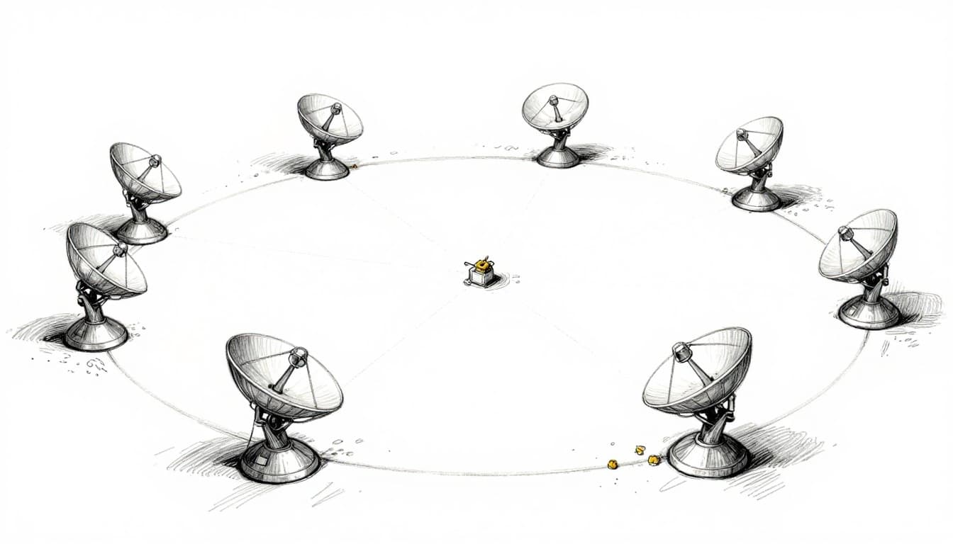
There’s also a visibility bonus. From GEO height, the satellite can “see” a large chunk of Earth. A common rule of thumb is that one GEO satellite can cover about one-third of the planet. That wide view is part of why GEO became a favorite for TV coverage and weather monitoring.
For more context on orbit categories, ESA’s guide gives a clear side-by-side look: ESA types of orbits.
Geostationary vs. Other Orbits: What Makes GEO Special
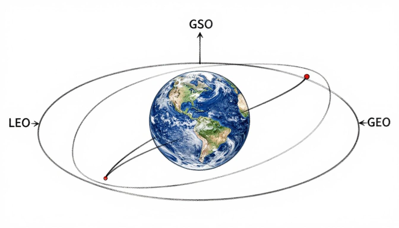
Most satellites don’t aim for a fixed “stay put” view. Many serve better with faster or higher paths. That’s why you’ll hear about LEO and GSO, along with GEO.
The key difference is how the satellite’s apparent motion looks from the ground.
- LEO (low-Earth orbit) satellites circle Earth close to the surface, often in about 90 minutes. They move fast across the sky, so ground antennas usually need tracking.
- GSO (geosynchronous orbit) means the period matches Earth’s rotation, but the orbit might be tilted. The satellite still completes a 24-hour loop, yet it traces a figure-8 pattern in the sky.
- GEO (geostationary orbit) is the special case. It’s geosynchronous plus equatorial and circular enough to appear fixed.
If you want a quick, plain definition of GEO vs GSO terms, this explanation is handy: Geostationary orbit overview.
Here’s the quick scan:
| Orbit type | Altitude/period (ballpark) | Why it’s not fixed |
|---|---|---|
| LEO | ~160 to 2,000 km, ~90 min | Too fast, moves across the sky |
| GSO | ~35,786 km, ~24 hours | Often tilted, so it traces a loop |
| GEO | ~35,786 km, ~24 hours | Near-zero tilt and near-circular shape keeps it steady |
That one “fixed” advantage matters. A stationary antenna can point once, then stay locked. That helps with TV dishes, many data links, and long-running weather sensors.
Station-Keeping: The Gentle Nudges to Fight Orbital Drift
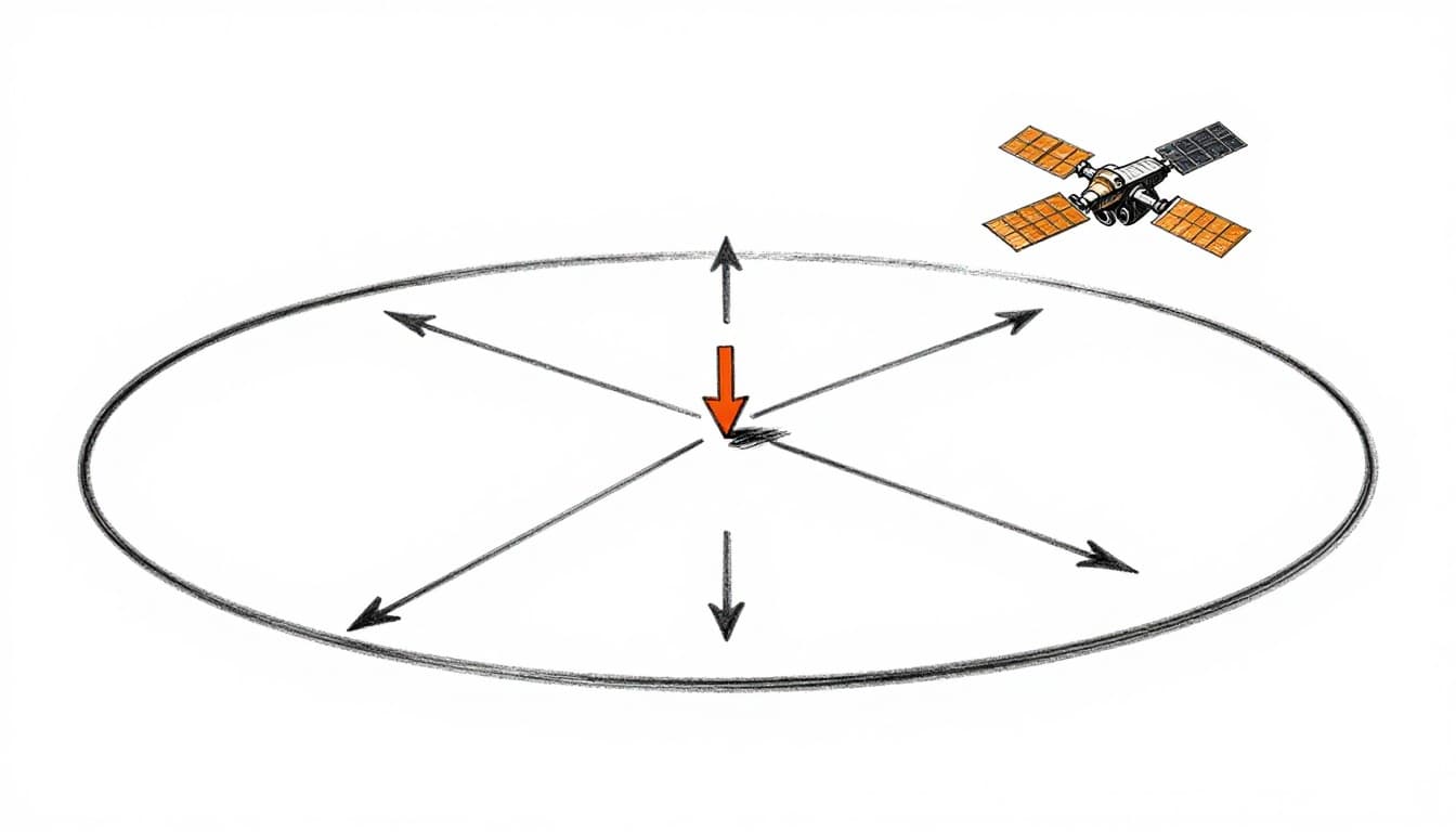
Now for the part people don’t see. Even if a satellite starts in the perfect GEO spot, it won’t stay perfect forever. Space forces add up slowly.
Gravity isn’t perfectly uniform. Earth is slightly “lumpy” because of its equator bulge and mass distribution. Then there are outside pulls from the Moon and Sun. Solar radiation pressure also matters, especially on large panels.
All those effects cause drift in two main directions:
- East-west drift (changes the timing slightly)
- North-south drift (tilts or shifts the orbital plane)
So operators use satellite station keeping to correct the position. Think of it like keeping a car centered in its lane. You don’t constantly brake or steer hard. Instead, you make small corrections, then coast.
Station-keeping burns use onboard propellant. Many GEO satellites fly for about 10 to 15 years. The exact lifespan depends on fuel reserves and how aggressive the correction needs to be.
In recent years, operators have also shifted toward better propulsion options. Electric propulsion systems are widely used for efficiency, especially when raising or refining orbits. As of the 2026 era, industry trends include hybrid approaches (electric for long, efficient work, chemical for quicker moves) and experiments with alternative propellants like iodine or green propellants to cut cost and improve supply options.
For deeper technical context on station-keeping strategies, this study looks at methods for north-south corrections: Efficient north-south station-keeping.
Common Drift Forces and How Thrusters Counter Them
The station-keeping plan only works because the main drift drivers are known. Operators model them, then schedule corrections.
Here are common forces that nudge GEO satellites:
- Moon and Sun gravity: these bodies pull unevenly as the satellite moves, slowly shifting position.
- Earth’s oblateness: Earth’s shape is not a perfect sphere, so the satellite’s orbit precesses over time.
- Solar radiation pressure: sunlight pushes on solar panels and structures, like a gentle pressure you can’t feel until it adds up.
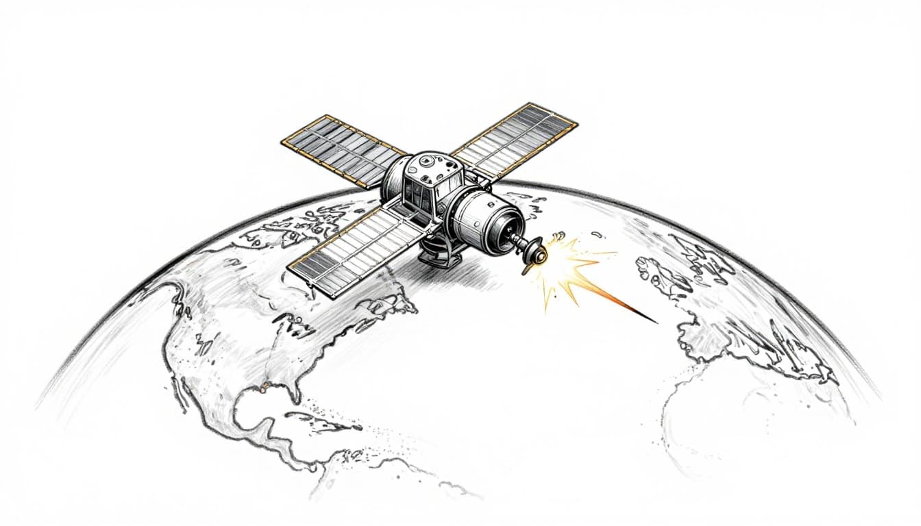
When drift grows large enough, thrusters fire in small bursts. Many GEO operators plan burns every few weeks or months. Then, they watch the satellite’s position, compare it to the target slot, and correct again.
Fuel management sets the clock. Once propellant runs low, a satellite has fewer options to avoid drift or handle anomalies. That’s why collision avoidance also matters. In a crowded GEO region, teams sometimes combine “keeping position” with “staying safe,” using extra maneuvers to reduce risk.
There’s also an international coordination piece. Operators don’t just pick any longitude. They share spectrum and orbit “slots” through coordination rules. Precise station-keeping helps prevent crowding problems from becoming real emergencies.
Real Challenges and Everyday Examples of Geostationary Satellites
Despite all the math and planning, GEO satellites still live with practical constraints.
Launch is one. Getting to GEO requires a specific path and energy budget. In many cases, rockets launch into a transfer orbit first, then the satellite uses propulsion to reach the final GEO altitude. Some missions aim for launch sites closer to the equator because Earth’s rotation helps provide an extra speed boost.
Fuel is another constraint. Every station-keeping burn costs propellant. Over time, teams reduce how often they correct, and they make choices based on risk and remaining fuel.
Debris is a third issue. GEO has lots of active satellites, plus retired craft that may still drift if not controlled. Operators watch conjunction warnings and run avoidance maneuvers when needed. Those maneuvers consume more fuel and reduce the remaining budget.
Meanwhile, GEO also supports daily life in ways that feel invisible. Weather maps on TV, storm alerts, and even the reliability of many TV channels depend on satellites that stay aligned.
In the US, NOAA’s GOES-R series provides much of the weather coverage. As of March 2026, GOES-19 serves as the main East/Atlantic weather satellite, with GOES-16 acting as backup. These satellites sit over fixed longitudes so sensors can scan the same regions again and again.
For a current overview of the GEO satellites NOAA and partners operate, see: NOAA NESDIS geostationary satellites.
Overcoming Launch and Lifespan Limits
GEO looks stable from your couch. In reality, it’s a long-term maintenance job.
Launch planning matters because it affects how much fuel remains for later corrections. Near-equator launch options can reduce the total workload of onboard propulsion. Still, transfer from launch to GEO is complex, so operators rely on careful burn timing and navigation.
Lifespan is tied to propellant reserves and how well the spacecraft handles drift. Electric propulsion trends can help stretch mission life because electric thrust can be efficient over long periods. Hybrid systems also help: electric propulsion handles much of the gradual work, while chemical propulsion can provide quicker adjustments when needed.
Even with improved propulsion, debris avoidance and unexpected events can shorten budgets. When a satellite nears end-of-life, operators follow procedures to move it away from operational slots, reducing collision risk.
So the “stay in one position” promise comes with a hidden truth. GEO satellites stay fixed through ongoing corrections, not because space is calm.
Conclusion
GEO satellites stay in one position because their orbital period matches Earth’s rotation at a height near 35,786 km. Gravity pulls inward, orbital speed creates the right balance, and the orbit sits over the equator so the satellite appears to hover.
After that, station-keeping takes over. Small thruster burns fight drift caused by the Moon, Sun, Earth’s shape, and sunlight pressure. That’s how operators keep a satellite aligned for years.
Next time your dish beams a show, think of the invisible ballet above. It’s not motionless, but it stays synchronized enough for you to forget it’s moving at all.