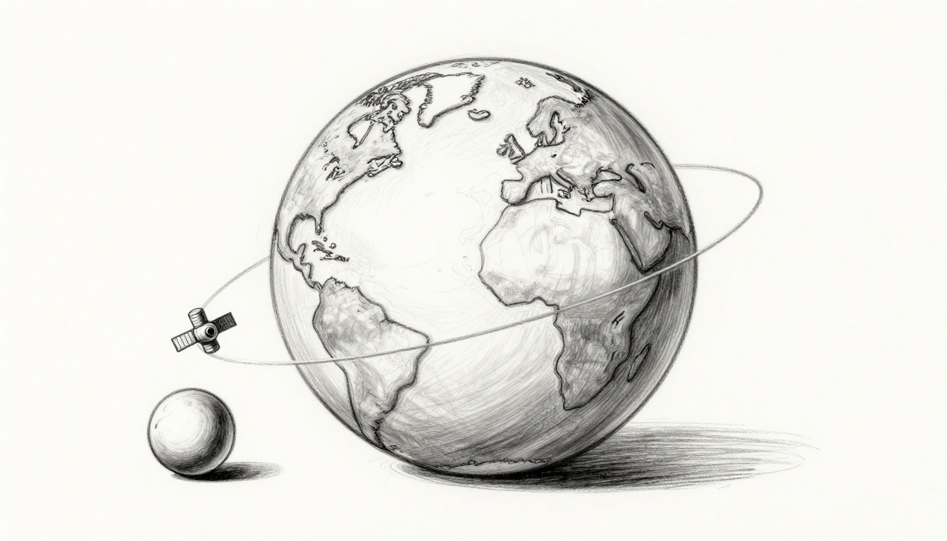
Why don’t satellites slam into Earth the moment they launch, even though gravity keeps pulling everything down? Picture you throwing a ball forward, then imagining you never let it stop falling. Instead, the ball keeps missing the ground because it moves fast enough sideways, and that’s the basic idea behind orbit.
Right now, space is busy: as of late March 2026, there are about 10,100 active satellites in orbit, and Starlink makes up over 10,000 of them. In total, more than 12,000 satellites have already been launched, with new ones going up almost weekly.
So how does the balance work, and what keeps a satellite from dropping out of the sky? Next, you’ll get a simple, no-math breakdown using everyday examples, plus the main orbit types and the forces that hold them in place.
Gravity’s Role in Curving the Path
When you throw a ball, it starts moving straight. Then gravity starts pulling it down. That pull keeps nudging the path into a curve, even while the ball keeps racing forward.
Think of gravity as an invisible hand that points straight toward Earth’s center. Because Earth is round, the ground keeps curving away. So the ball does not just fall in place. Instead, it keeps missing the ground, time after time.
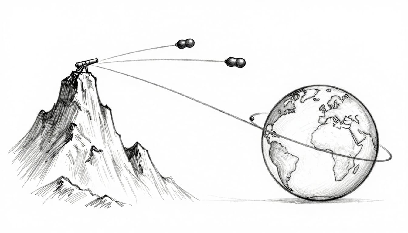
In Newton’s cannonball idea, that “miss” is everything. The ball is always trying to go straight (inertia), and gravity is always trying to pull it downward. Orbit happens when those two effects fit together so well that the ball keeps curving around Earth instead of crashing.
Gravity pulls inward, like a constant “downhill” toward Earth
Gravity does not turn off once the ball is in the air. It keeps acting from the first second to the last. That’s why the ball’s path bends. Each moment, gravity steals some of the ball’s upward motion and sends it down a bit more.
Now picture the force like a steady pull on a leash. You might throw the ball hard to the side, but gravity keeps tightening the “pull” toward the center. As a result, the ball’s path becomes an arc, not a straight line.
This is the same reason planets and moons behave the way they do. They do not float because space is “no gravity.” Instead, they float because gravity is there, all the time. It just matches their sideways motion.
Centripetal force is the curve-maker, not a separate force
People sometimes hear the phrase “centripetal force” and think it’s something extra. In simple terms, it’s just the inward pull that makes curved motion possible.
Gravity is the source. It supplies the inward change in direction. You can feel this idea when you swing a bucket of water on a string. Your hand pulls inward, and the water follows the curve, even though it wants to fly outward.
Satellites follow a similar rule. They are not glued to Earth. They are in a steady fall around Earth. Their sideways speed stays high, while gravity keeps pulling inward, reshaping the path again and again.
Here’s the key picture in your mind: the satellite’s path is always curving because the pull is always inward.
A satellite “falls” forever because the fall keeps bending around Earth, instead of straight down to the ground.
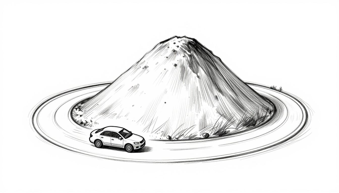
The car-on-a-round-hill analogy: speed matches the curve
A car on a round hill gives you a strong intuition. If the car goes too slowly, it can’t make the turn. Gravity pulls it down, and it rolls off the track.
However, if the car goes fast enough, the curve works with the speed. The road bends, the car keeps moving sideways fast, and it stays on the circular path. It feels like it’s “stuck,” but it’s really a nonstop balance.
Satellites work the same way, just without roads. Earth’s curved shape sets the “track” under gravity. The satellite’s speed is what decides whether it will:
- Drop inward (too slow, it spirals down)
- Travel on an ellipse (speed is high, but not perfect)
- Circle steadily (speed matches the needed curve)
That match is what keeps it from landing. The orbit is not a pause in falling. It’s a loop in falling, with the loop repeating smoothly because gravity and speed stay in sync.
The Perfect Speed Match for Stable Orbits
Stable orbits come down to one idea: your sideways speed has to match the pull of gravity at that altitude. Too slow, and you spiral inward. Fast enough, and you keep missing Earth forever.
Meanwhile, empty space does not “run out” or slow you down the way a driveway does. In an ideal world with no air drag, a satellite keeps going because it keeps its motion, in line with Newton’s first law. Gravity still bends the path, but it does not erase the sideways speed. That mix is what turns free-fall into a loop.
Real Speeds by Altitude
Here are typical orbital speed ranges for the two most common satellite neighborhoods. Notice how the higher the orbit, the slower the satellite moves relative to Earth.
| Orbit type | Typical altitude | Approx. orbital speed |
|---|---|---|
| LEO | 150 to 2,000 km | about 28,000 km/h |
| GEO | about 36,000 km | about 11,000 km/h |
For a concrete example, the ISS flies around Earth at roughly 400 km altitude and zips along near 28,000 km/h. That speed matters because the station lives close to the stronger pull of Earth.
Now compare that with geostationary satellites. GEO sits much farther out, near 36,000 km above Earth. At that height, satellites move at about 11,000 km/h, and they can stay above nearly the same point on the ground.
So why does “higher means slower” happen? It comes from gravity getting weaker with distance. Farther out, Earth pulls less strongly inward. Because the pull is gentler, the satellite needs less sideways speed to keep the same kind of “curve” around Earth.
If you like a road analogy, think of a race car on a banked track. On a steep bank, you can hold the turn at higher comfort with less speed, because the track does more of the job holding your path. On a flatter section, the car needs more speed to keep from sliding outward. Orbits are the same idea, just with gravity doing the banking.
The “balance point” you can picture (no math)
You can understand orbital speed without equations if you picture this balance:
- Gravity pulls inward, like Earth’s curve grabbing the satellite’s path.
- Forward velocity carries it sideways, so it keeps “arriving” at the curved path.
- When those two match, you get a stable loop, not a fall.
At low altitudes, gravity grabs harder, so the satellite must move faster to keep bending around Earth instead of dropping into it. At higher altitudes, gravity grabs less, so the satellite can move slower and still stay in a stable orbit shape.
That is the perfect speed match. It turns nonstop free-fall into a repeatable travel pattern, one orbit at a time.
Common Orbit Types and What They Do
Most people ask one simple question, “How can a satellite keep from falling?” The short answer is that it falls around Earth, not straight down. Different orbit types just fit different jobs, like putting different tools in different boxes.
A satellite’s altitude, speed, and tilt decide how it moves over time. As you read the examples below, keep one idea in mind: the same physics works everywhere, but the outcomes look different.
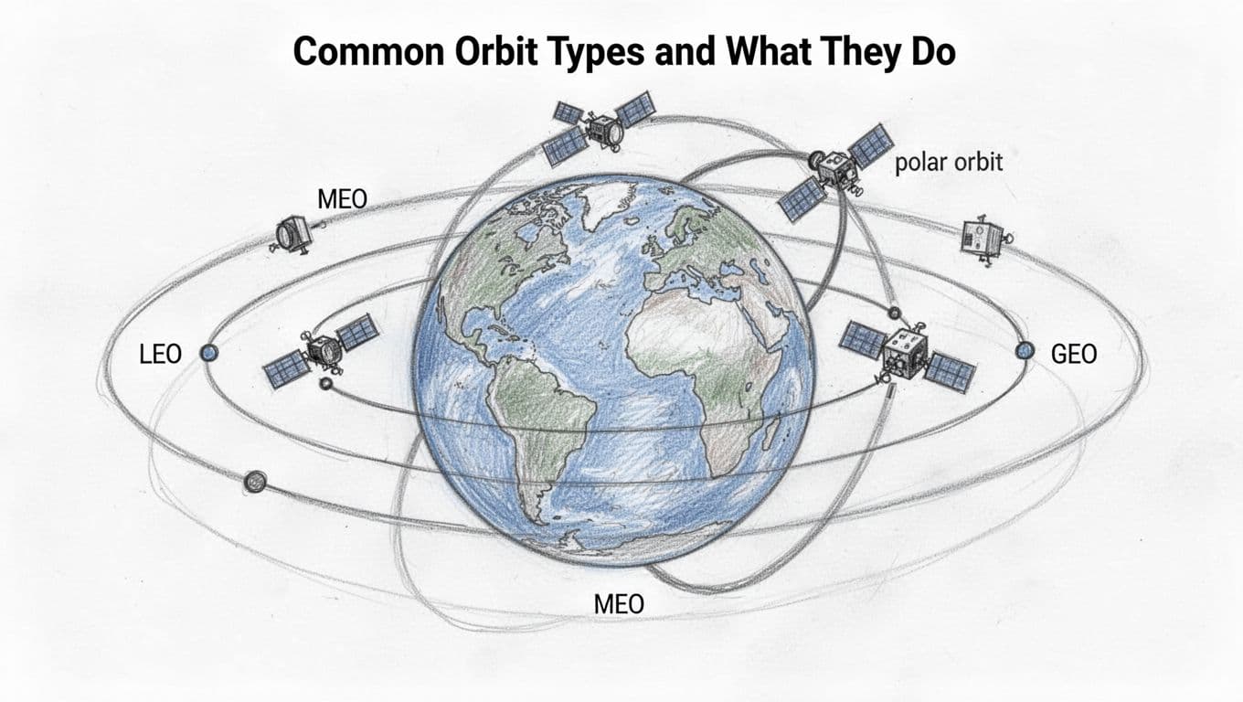
Low Earth Orbit: Close-Up and Quick
Low Earth Orbit, or LEO, sits roughly 150 to 2,000 km above Earth. In this zone, satellites move fast, so they sweep across the planet quickly. That speed helps with tasks that need frequent updates, like weather monitoring and imaging.
If you’ve heard of Starlink, you can picture most of those satellites living in LEO, often around 550 km. Because there are thousands of them, the network can cover many places at once. One satellite might pass over your area in minutes, but another comes along soon after. That’s why LEO internet can feel responsive.
Speed is the big reason LEO works. At lower altitudes, Earth pulls harder, so the satellite must go faster to stay in a stable loop. As a result, a typical LEO satellite can complete an orbit in about 90 minutes. That means repeated passes, day after day.
So what does that look like in real life? Here are common LEO uses:
- Earth imaging and mapping: Satellites can revisit the same region often.
- Low-lag communication: Signals travel shorter paths than higher orbits.
- Some navigation support: Many systems use LEO satellites for timing and positioning.
However, LEO isn’t “set it and forget it.” The air at those heights is thin, but it still exists. That creates drag, which slowly robs satellites of speed. Over time, they need reboosts, or they must be deorbited at the end of life.
If you want a clear baseline for what “orbit types” mean, NASA’s overview of orbits is a good starting point: NASA Earthdata’s orbits basics.
In short, LEO is ideal when you want quick motion and frequent coverage, even if the satellites must manage drag.
Geostationary Orbit: Locked in Place Above One Spot
Geostationary orbit, or GEO, sits much higher, around 36,000 km above Earth. At that distance, a satellite’s orbital period matches Earth’s rotation period. Because of that match, the satellite appears to stay in one place in the sky.
That “locked” behavior is why GEO is so common for services that benefit from fixed pointing. A ground dish antenna can point in one direction, then keep tracking the satellite without chasing it across the sky every minute.
For many viewers, GEO is the hidden workhorse behind satellite TV and other broadcast-style services. It can also support weather monitoring and some long-range communication links. The tradeoff is simple: GEO satellites live far away.
Being far away has two major effects. First, it takes more energy (and higher cost) to reach and maintain that altitude. Second, signals take longer to travel between Earth and the satellite. The delay can matter for voice and real-time applications, even if the link stays steady.
Here’s the key idea behind the “stillness.” Earth turns, and GEO satellites orbit at just the right speed so their motion matches Earth’s spin. So relative to a person standing still on the ground, the satellite hardly moves.
That also shapes the practical design of the system. With GEO:
- Your antenna can stay mostly fixed.
- Coverage tends to be stable over a targeted region.
- Service planning uses “which spot in the sky” rather than “which pass window.”
Of course, GEO also has limits. Since satellites share that same ring of space above the equator, operators must carefully coordinate locations to avoid interference. Space is not infinite, even when the orbit is.
So, if LEO is all about fast loops, GEO is about one spot that stays put. For broadcast needs and steady coverage, that difference is exactly what operators want.
Battling Drag: How Satellites Maintain Their Orbits
Even in space, satellites do not live in a perfect “no-fall” bubble. Instead, they fight a slow enemy: drag. Tiny atmospheric particles in low Earth orbit skim the upper air, nudging the satellite and stealing speed. Once speed drops, gravity wins, and the orbit shrinks over time.
To stay aloft, operators use small, planned boosts. Think of it like keeping a bicycle balanced while riding through light wind. You do not need constant power, but you do need steady corrections.
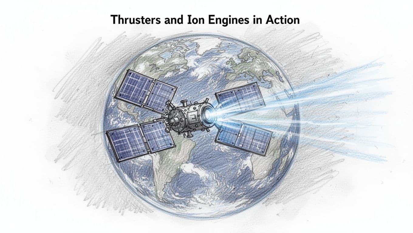
Thrusters and Ion Engines in Action
Satellites handle orbit upkeep with two main styles of propulsion: chemical thrusters and ion engines. Chemical systems give quick bursts. They burn fuel fast, creating higher thrust for short burns, like trimming the orbit right now.
Ion engines push differently. They deliver efficient, slow thrust by using electricity to accelerate charged atoms. Because the thrust is gentle, they run for long periods, which is perfect for station-keeping. As a result, operators can stretch onboard propellant farther, a big deal for mega-constellations with many satellites.
Here’s why this matters for drag:
- Drag steals speed, which lowers altitude.
- Lower altitude means stronger drag, which speeds up the problem.
- Thrusters restore the lost speed and keep the orbit from “walking down.”
For a deeper look at the propulsion tradeoffs, see a clear comparison of electric versus chemical approaches in GEO satellites from a recent study: electric vs chemical propulsion effects.
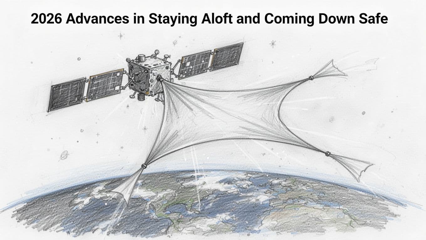
2026 Advances in Staying Aloft and Coming Down Safe
In 2026, operators get better at two jobs at once: predicting the drag that pulls satellites down, and managing the end-of-life descent. First, smarter models use more data and better math to forecast how the atmosphere will behave days ahead. Then, that forecast feeds into planning so satellites burn fuel only when it helps.
Another tool gets attention in the real world too: drag sails. These are thin, controlled surfaces that increase drag at the end of a mission. When deployed, they help the satellite lose altitude faster and re-enter more predictably. That reduces the chance of leaving long-lived junk in orbit.
For context, the U.S. FCC rule pushes operators toward timely disposal. In simple terms, many LEO satellites must deorbit within a set window after mission end, which is why drag-based deorbit plans matter. The official FCC details are here: FCC 5-year deorbit rule.
Meanwhile, mega-constellations keep scaling. As of late March 2026, there are over 10,000 active satellites, with Starlink at around 10,000 working satellites and expanding through frequent launches. With that scale, even small improvements in drag prediction and propulsion planning reduce wasted fuel and lower collision risk.
Also, some operators adjust orbits during operations for safety. For example, reporting on SpaceX lowering certain Starlink orbits shows how operators respond when things go wrong: SpaceX lowers Starlink orbits for safety.
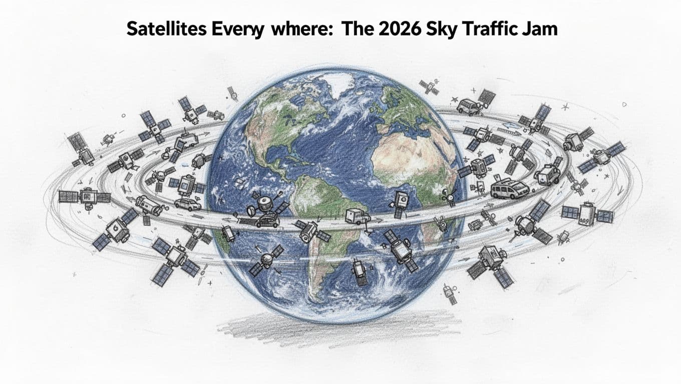
Satellites Everywhere: The 2026 Sky Traffic Jam
Space used to feel empty, at least from a distance. Now it feels busy, and the busiest part sits in low Earth orbit (LEO). In late March 2026, there are over 10,000 active satellites in orbit, and Starlink dominates LEO. That means your sky can look normal, but the lanes above you keep filling in.
The “traffic jam” part does not mean satellites are crashing every day. It means they share space more tightly than before. And when objects pack closer, operators must watch each other closely, plan safe passes, and move fast when they need to.
Meanwhile, launches keep coming because getting to orbit got cheaper. If rockets can fly more often, constellations can grow faster. That is the core boom behind what people now call mega-constellations, and it also explains why the number of satellites keeps rising.
March 2026 numbers that make the sky feel crowded
Here are the headline stats that show how quickly the orbit “population” has grown:
- Over 12,000 total satellites active or launched in this period, depending on the snapshot you use.
- Starlink is the main crowd in LEO, with about 6,500 Starlink launched in the broader reported time window and thousands more added since.
- China’s mega-constellations are growing, but they do not match Starlink’s pace in the same time frame.
Keep in mind, not every launched satellite stays active forever. Some burn up on the way down. Others shut off. Still, the overall trend is clear.
For a concrete read on Starlink’s scale, KeepTrack monitors near real time and reported Starlink at 10,087 active around March 22, 2026, with 10,097 currently tracked operational in that report cycle (you can see the context in KeepTrack’s latest Starlink count). When you compare those numbers month to month, it’s easy to see why the phrase “sky traffic jam” keeps showing up.
Why we notice the traffic more now
You can fly a plane safely through busy airspace, but only if controllers keep it organized. LEO works similarly, except the “controllers” are mostly automated tracking systems and operator procedures.
So why do we notice the traffic now?
First, there are more satellites per shell around Earth. That reduces the spacing between nearby objects. Second, more services depend on steady operations, like internet coverage. Operators cannot just “wait and see,” they must avoid risky closeness.
Finally, some satellites become visible at dusk, especially during clear, dark viewing windows. People report seeing train-like lines of Starlink moving across the sky. That visibility is a side effect of the satellites being numerous, bright, and close to where sunlight still hits them at the right angles.
How collision risk gets managed (without panic)
Even at crowded densities, collisions do not have to happen. Operators prevent most problems with early detection, prediction, and timely avoidance.
When two objects might pass too near, the system flags a conjunction. Then the operators decide what to do, often using a small maneuver to adjust the satellite’s path slightly. At orbital speeds, even tiny changes can matter a lot.
Here’s what the risk management process usually boils down to:
- Track and predict where each satellite will be over the next hours or days.
- Compare predicted paths to find close-approach chances.
- Plan avoidance maneuvers if the predicted miss distance looks too small.
- Update plans as new tracking data comes in.
It helps that operators already expect these events in a crowded LEO environment. Reports also describe how Starlink performed large numbers of collision-avoidance maneuvers in recent years, which you can see discussed in SpaceX’s maneuver count coverage.
The scary part is the word “collision,” but the safe part is that avoidance is planned, frequent, and data-driven.
Big impact on global internet, plus some real tradeoffs
The upside is huge. More satellites mean broader coverage and faster connections in places that land-based networks reach slowly. When a constellation grows, it can offer more beams, more links, and better availability.
That said, the tradeoffs show up in three places:
- More coordination work: more objects means more chances for near misses.
- More space traffic management: operators rely on better tracking and better rules.
- More concerns about the night sky: visible satellite trains change how people see the heavens.
If you want a broader view of why the sky can get disrupted at scale, Scientific American covered concerns about the rapid growth of mega-constellations and its effects on visibility and long-term space conditions in Scientific American on mega-constellations growth.
So yes, satellites are everywhere in 2026. Yet the “traffic jam” does not mean the system stops working. It means the margin for error shrinks, and the need for smart orbit control grows every month.
Conclusion
Satellites do not stay up because gravity stops. They stay up because gravity and speed stay in balance, so the craft keeps “missing” Earth as it falls around the planet.
Just as important, operators manage the slow push of drag. Small thruster burns and long-running ion engines help satellites hold their paths, while end-of-life plans and tracking systems keep the crowded orbit safer.
Next time the sky clears, look up on a dark night and find a passing satellite line, especially if you’ve seen Starlink before. Then share your best sighting tips in the comments, and tell me what you want to learn next as the number of satellites tops 10,000 active, plus thousands more already launched, keeping more of the world connected.