The next time you check GPS directions or watch satellite TV, pause for a second. You’re getting a signal from hundreds of miles (and sometimes thousands) above Earth. It feels like magic, yet it’s mostly math, planning, and timing.
Ever wonder how one satellite can serve billions? It’s not really one satellite doing all the work. Satellites cover huge areas by flying in the right paths, working in groups, and handing off service as they move.
In March 2026, satellite internet is growing fast, especially in the US. So the question matters more than ever. Next, you’ll see how orbits and constellations make wide coverage possible, then the tech that keeps signals strong while you’re moving.
What Orbits Help Satellites Blanket the Planet?
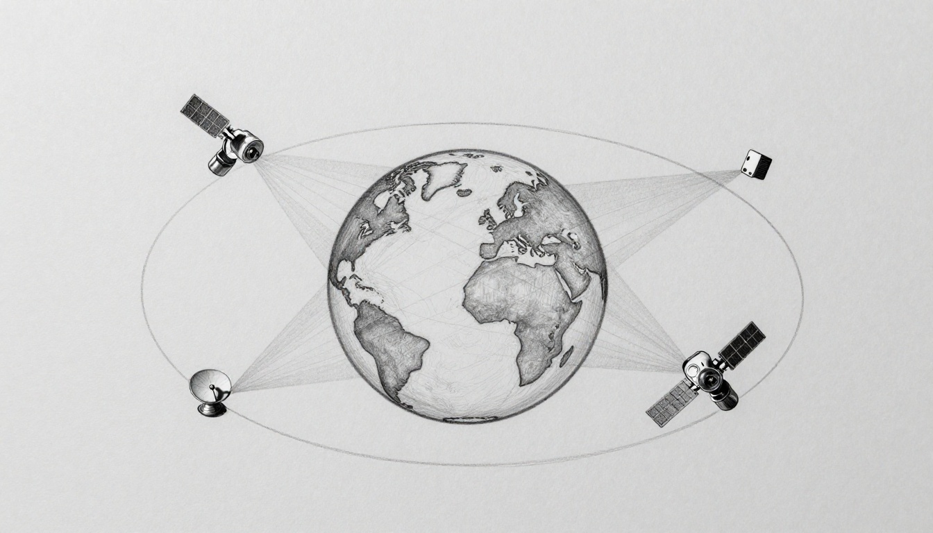
Satellites don’t “blanket” Earth the way a blanket covers a bed. Instead, each satellite has a limited view at any moment. Orbit design tells satellites where they can “see” ground stations or user terminals.
Think of it like standing on a hill. If you move farther up, you can see more land. But you also change how fast you move across the view. That tradeoff drives the big three orbit types: GEO satellites, LEO orbits, and MEO.
If you want a helpful overview of how orbit choices link to coverage, see satellite orbits and coverage basics.
Geostationary Orbit: The Fixed View from High Above
GEO satellites sit around 36,000 km above Earth’s surface. At that height, they can match Earth’s spin. So to you, they look like they stay in one spot.
That “fixed” view is why GEO works well for services like TV and weather monitoring. You can aim a dish once, and it keeps tracking the same sky point.
However, GEO isn’t perfect everywhere. A single GEO satellite can cover roughly one-third of Earth, but it mainly works best for regions near the equator. As you move toward the poles, the satellite’s angle gets too low. In plain terms, the signal has to travel through more atmosphere and land blocks. So poles can get weak or unreliable.
A simple way to picture it: imagine a balloon tied over your neighborhood. It stays above you. That makes setup easier. But it won’t float nicely over every neighborhood on the map.
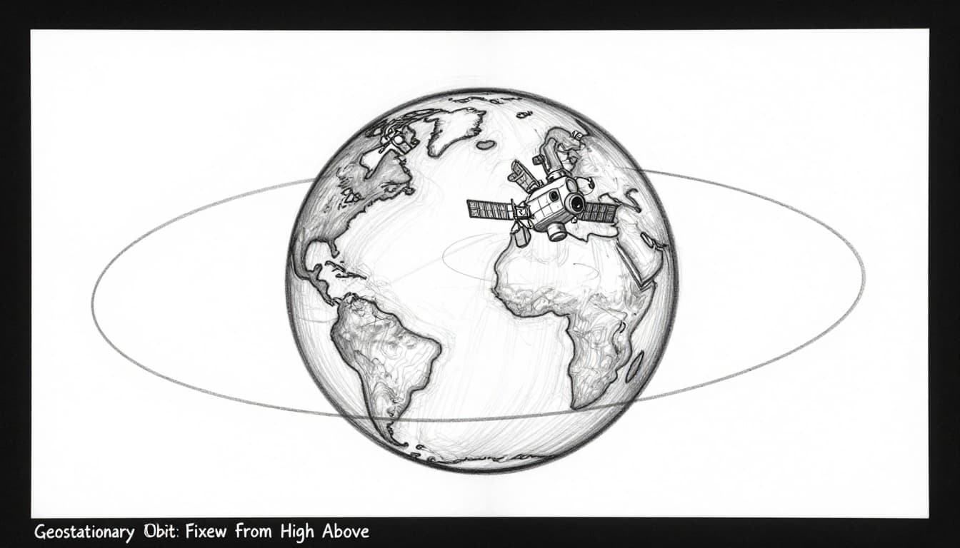
There’s also a built-in downside. GEO signals travel a longer distance, so latency (delay) tends to be higher than in low orbits. For people who play games or use real-time video calls, that delay can be noticeable.
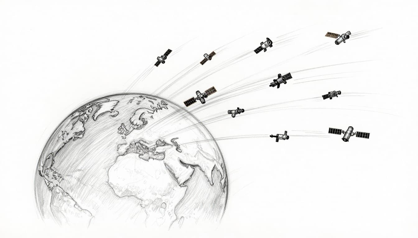
Low Earth Orbit: Zipping Around for Close-Up Coverage
LEO orbits run from about 500 to 2,000 km above Earth. Since they’re closer, the signal travels less distance. That usually means lower latency.
LEO also covers wide areas because each satellite has a strong “footprint” from low altitude. Yet here’s the catch: LEO satellites move quickly. In many cases, they circle Earth in roughly about 90 minutes.
So one LEO satellite can’t stay over the same region long. Instead, you need many satellites. That’s how coverage turns into a moving net.
Another analogy helps here. Picture a flock of birds flying low and fast. At any given moment, only part of the flock is over your area. But the flock is always moving in and out, and the group keeps the overall coverage alive.
LEO has its own tradeoffs. More satellites means more engineering on tracking, switching, and network control. Still, this orbit type is behind much of the satellite internet growth in 2026.
Medium Earth Orbit: Finding Your Spot with Balanced Reach
MEO sits between GEO and LEO, roughly from 2,000 to 35,000 km up. A well-known MEO job is navigation, especially systems like GPS.
MEO satellites don’t “hover” like GEO satellites. They also don’t rush around like LEO. Instead, they offer a middle path: lower latency than GEO, and wider coverage than LEO on a per-satellite basis.
That balance matters for navigation. When you’re guiding a phone, car, boat, or plane, you want solid coverage and timing that stays consistent.
So which orbit blankets Earth best? It depends on the service. GEO can cover large zones with fewer satellites. LEO can deliver low delay but needs a bigger fleet. MEO often fits when you want a strong middle ground.
A quick pros-and-cons snapshot:
- GEO satellites: fewer satellites, stable pointing, but higher delay and weaker polar coverage
- LEO orbits: low delay and strong coverage, but fast movement needs thousands of satellites
- MEO: good balance for navigation and some comms, fewer satellites than LEO, usually not fixed over one point
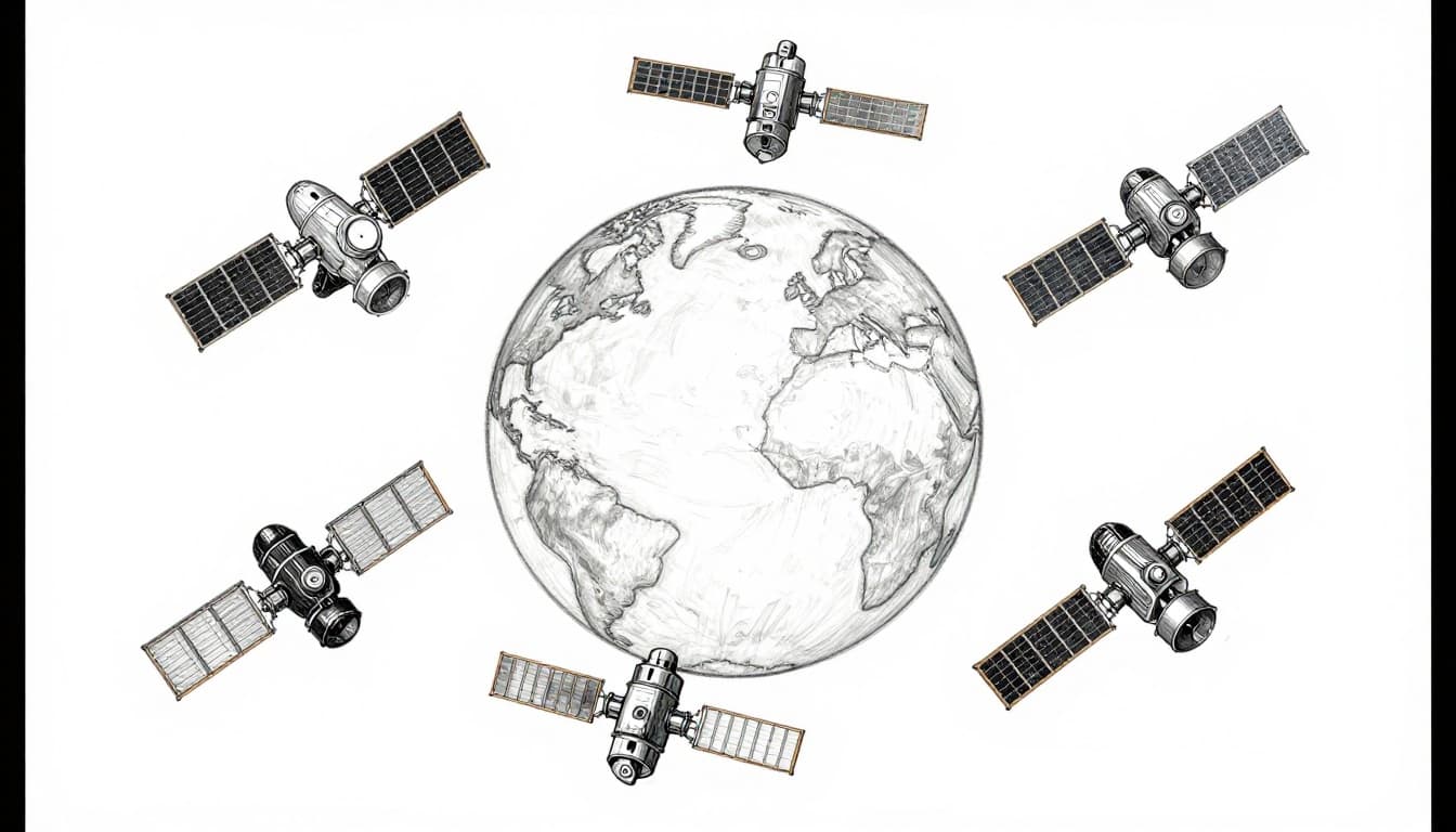
How Do Satellite Constellations Achieve Worldwide Reach?
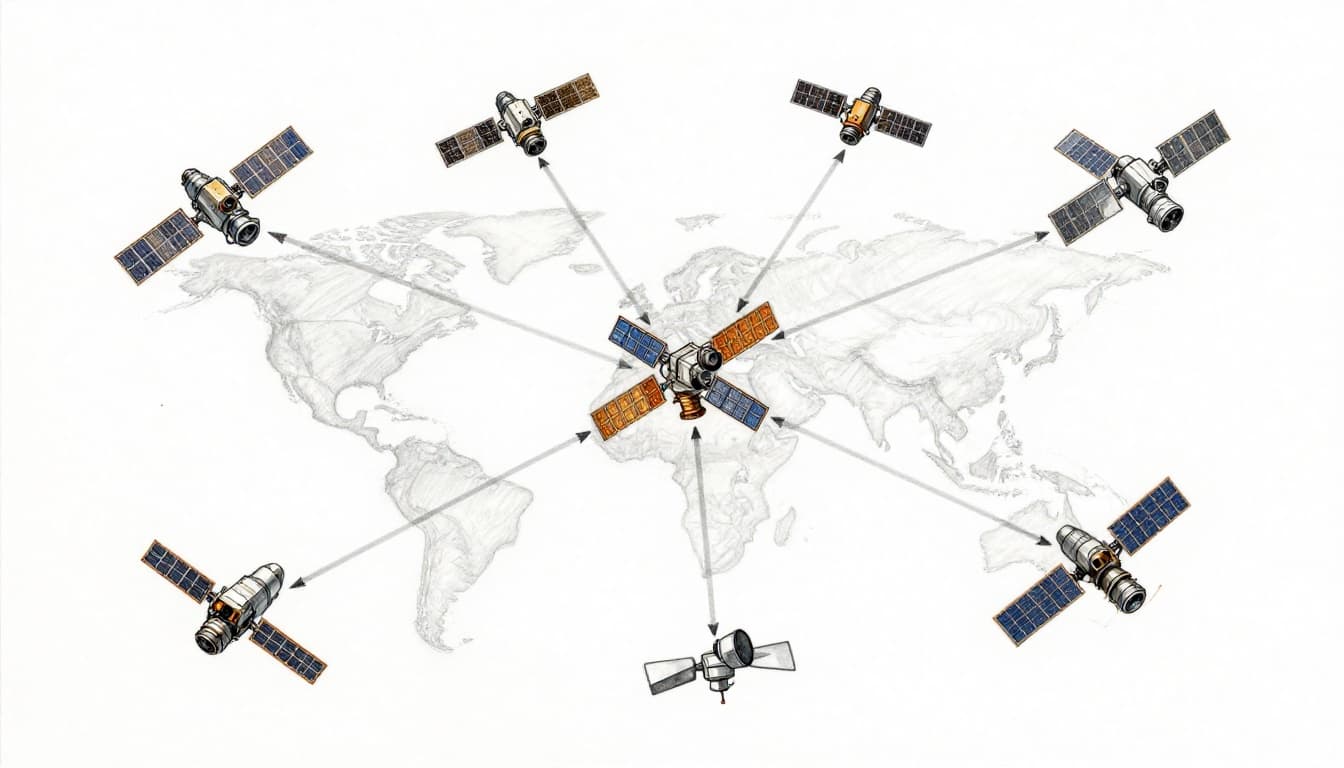
Orbits tell satellites where they can fly. Constellations tell them how to work together. A constellation is basically a team, often with thousands of satellites spread into several orbital shells.
This teamwork is the key to wide coverage. One satellite has a limited view of Earth. As it moves, its view changes. That means the network needs overlap.
Think of a relay race. When one runner passes the baton, the next runner is already in stride. For satellite coverage, the baton is your connection.
This is especially true for LEO and many MEO designs. Because satellites move, your device can’t stick with one satellite for long. Instead, your terminal tracks one satellite, then hands off to the next one.
Also, constellations can reduce dead zones. In an ideal setup, as one satellite’s angle drops, another satellite’s angle rises. The handoff can keep service steady across a continent, or even across the whole globe.
Teaming Up Multiple Satellites to Eliminate Gaps
Overlap is what turns “limited view” into “worldwide reach.” Engineers place satellites so that their coverage zones overlap at Earth’s surface. Then they schedule switching so users stay connected as satellites pass overhead.
Here’s what that looks like in practice:
- Coverage overlap: multiple satellites “see” the same region at different times
- Walking handoffs: your device switches to the next satellite as geometry changes
- Layering shells: different orbits and inclinations fill gaps and support higher reliability
This is why many modern systems aim for constellations, not one-off satellites. You might hear people say “satellite internet uses thousands of satellites.” That’s not hype. It’s a coverage math problem.
As networks grow, the service gets better in two ways. First, more satellites means more overlap. Second, better control software means smoother handoffs.
Smart Technologies That Make Coverage “Works-When-You-Need-It”
Even with the right orbits, coverage can still fail in the real world. Buildings block signals. Weather can weaken some links. Antennas move, especially on cars and ships. So satellite networks use specific tech to keep service strong.
Three ideas show up again and again: spot beams, handoffs, and inter-satellite links.
Spot Beams: Pinpointing Power to Busy Areas
Not every patch of Earth needs the same power. If a satellite spreads power everywhere, the signal gets weaker where demand is high. So many systems use spot beams.
A spot beam acts like a flashlight with a tight cone. Instead of lighting up the whole room, it concentrates on one corner. On the ground, that means faster speeds and more capacity in crowded areas.
Spot beams also help with fairness. If rural users compete for the same power as cities, everyone pays the price. With spot beams, the network can steer capacity toward where it’s needed.
High-throughput satellite (HTS) designs also connect to this approach. HTS satellites use smarter payloads to send more data using advanced frequency reuse and beam shaping.
Handoffs: Keeping Your Connection Alive on the Move
LEO satellites move fast across your sky. So your device can’t keep talking to just one satellite forever. That’s where handoffs come in.
A handoff is the switch from one serving satellite to the next. The system predicts which satellite will be best next, then moves the link before signal quality drops too much.
You can think of it like a baton pass. The first runner hands off to the next runner. If the pass happens early enough, nobody slows down.
In practice, the network manages timing, frequency, and routing. Beam direction also matters, since spot beams can change where the signal lands.
For a more technical look at how beam and handover control works in LEO networks, see beam management in LEO with handover control.
Inter-Satellite Links: Direct Chats Between Orbiters
Most satellite networks also use ground stations. That’s normal. But ground paths can add delay and reduce flexibility.
To cut those effects, newer systems add inter-satellite links. These let satellites send data to each other directly, often using lasers or radio links.
When satellites can relay data in space, the system can route around congestion and avoid forcing every message down to Earth. In other words, the network can stay “closer to the sky path” instead of bouncing everything through terrestrial links.
This approach also supports broader service coverage. If a ground station isn’t in the right view, satellites can still route traffic until the next station comes into range.
Real Examples, Challenges, and What’s New in 2026
March 2026 is a good moment to ask this question, because the satellite internet race is accelerating. More launches, denser constellations, and better beamforming all help coverage improve.
But it’s not just about adding satellites. Coverage also depends on how signals are routed, how often handoffs happen, and how smart the beams are.
Starlink and Iridium: Coverage in Action
Starlink is the best-known example of LEO constellation coverage. Starlink’s network has grown rapidly, and it now has nearly 10,000 satellites in low Earth orbit for wide coverage and lower latency.
Starlink also uses inter-satellite laser links to route traffic between satellites. That helps reduce reliance on ground segments for every hop.
If you want a solid reference point for the constellation itself, see Starlink satellite internet constellation.
Meanwhile, Iridium takes a different approach. Iridium has a LEO network designed for reliable coverage, including high latitudes. That makes it a common choice for satellite phones in places where terrestrial networks struggle.
For a quick view of where Iridium service works, check Iridium coverage map.
Tackling Tough Spots Like Poles and Jams
Wide coverage meets hard problems fast. One big issue is geography. GEO satellites struggle near the poles, because the satellite’s view angle gets low. LEO networks handle poles better, but they still face fast-changing geometry.
Another challenge is signal blocking. Mountains, buildings, and even tree cover can weaken a link. Using better antennas and smarter beam steering helps, but physics still wins sometimes.
Then there’s crowding in space. More satellites mean tighter coordination and more work for traffic management. Networks also rely on tracking and rules that reduce collision risk.
Finally, there’s congestion. Even if a region is technically covered, too many users can overwhelm capacity. Spot beams, frequency planning, and smarter routing can help balance demand.
In March 2026, solutions often look like this:
- Multi-orbit mixes to cover weaknesses in one orbit type
- Better handoff control so your connection switches before quality drops
- Improved routing and network switching (including modern routing and traffic tools) to manage load
These changes matter because coverage isn’t only about “can it see Earth.” It’s also about “can it keep the signal usable.”
Conclusion: The Real Answer to “How Do Satellites Cover Large Areas?”
Satellites cover big parts of Earth through a stack of choices, not one trick. First come the orbits, which decide how much each satellite can see and how fast it moves. Next come constellations, which overlap coverage zones and keep switching going as satellites travel. Finally, tech like spot beams, handoffs, and inter-satellite links makes the connection hold up in real conditions.
So the next time you ask, “How do satellites cover large areas?” remember the core truth: they don’t do it alone. They do it as coordinated systems above you.
If you use satellite services, share what you rely on most, GPS, calls, or internet. And what’s your dream for space-based coverage in the US?